Skip to main contentResource added 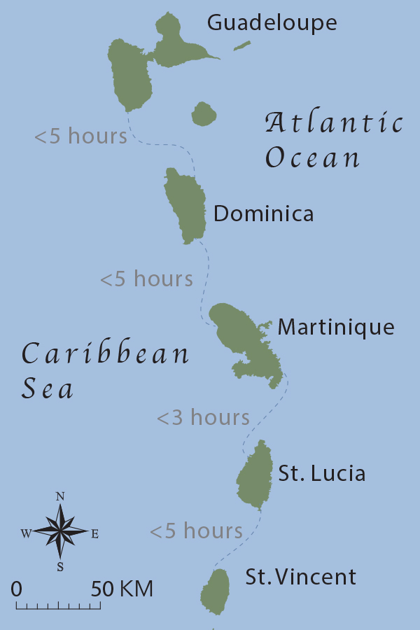


Map 2.2, The Eastern Caribbean
Full description
MAP 2.2. The Eastern Caribbean. Dotted lines represent the amount of time it took Père Jean-Baptiste Labat to travel by canoe between islands. Using Labat’s journal, Tessa Murphy was able to calculate transit time. See Murphy, Creole Archipelago, 33, footnote 32. Illustration by author.
Comments
to view and add comments.
Annotations
No one has annotated a text with this resource yet.
- typeImage
- created on
- file formatjpg
- file size130 kB