Skip to main contentResource added 

Map 1.1, Dominica's Rivers and Precipitation
Full description
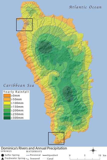
MAP 1.1. Dominica’s rivers and annual precipitation. Rectangles designate Portsmouth (in the north) and Soufriere (in the south). Illustration by author.
Comments
to view and add comments.
Annotations
No one has annotated a text with this resource yet.
- typeImage
- created on
- file formatjpg
- file size1 MB