Skip to main contentResource added 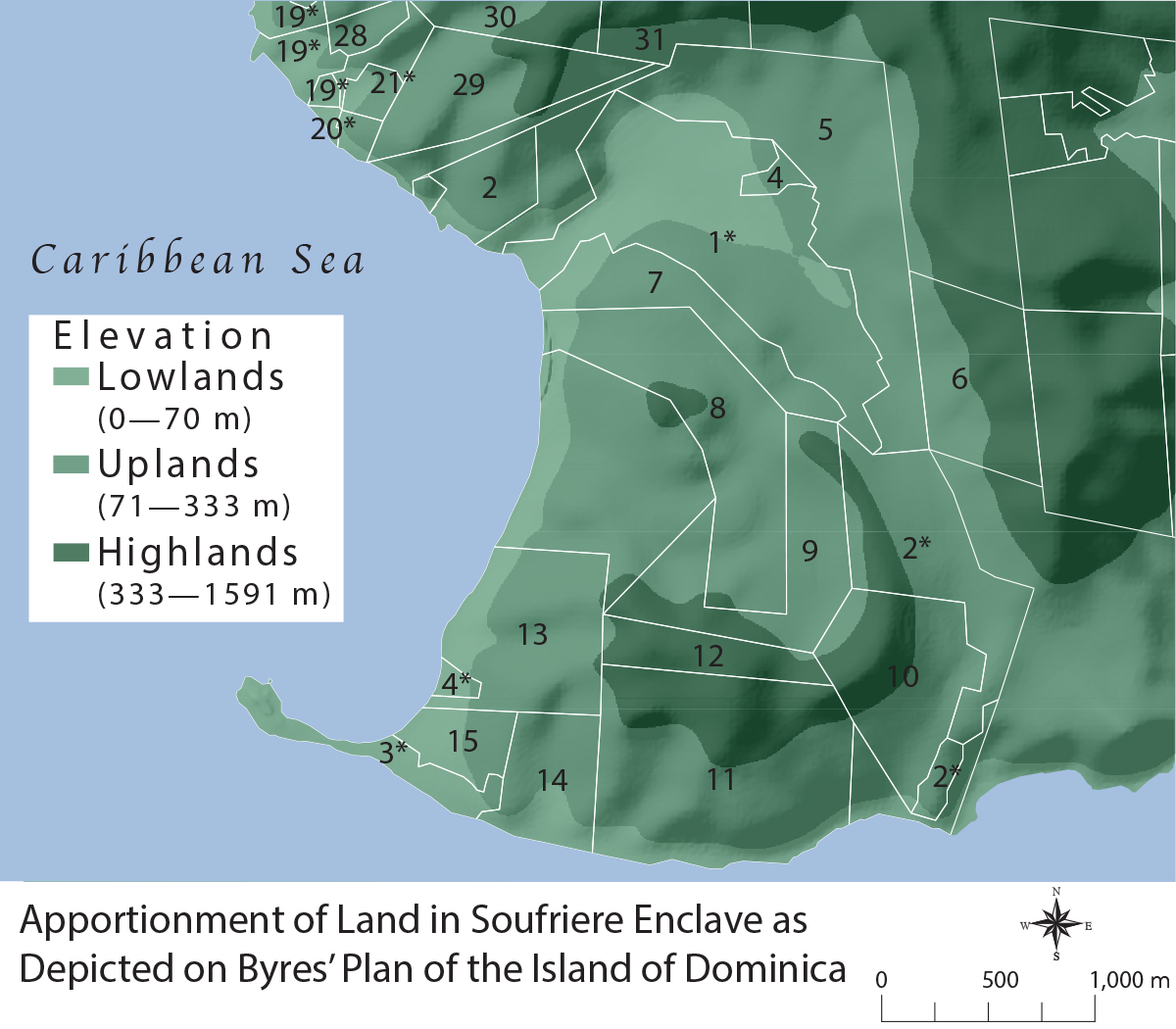

Map 3.2, Land Apportionment in Soufriere
Full description
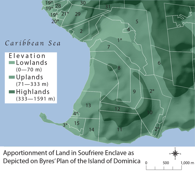
MAP 3.2. Apportionment of land in the Soufriere Enclave as Depicted on Byres’s “Plan of the Island of Dominica.” Numbers are indexed to specific proprietors or leaseholders in Byres’s References to the Plan of the Island of Dominica. Freeholds are displayed as plain numbers, and leaseholders as numbers with an asterisk. Bois Cotlette included 2*; Morne Patate 7, 8, and 9; Morne Rouge 11; and Crabier 12. Illustration by author.
Comments
to view and add comments.
Annotations
No one has annotated a text with this resource yet.
- typeImage
- created on
- file formatjpg
- file size511 kB