Skip to main content
Menu
Contents
A Ming Confucian’s World: Maps
A Ming Confucian’s World
Maps
Visibility
Show the following:
Annotations
Yours
Others
Your highlights
Resources
Show all
Reader Appearance
Adjust appearance:
Font
Font style
Serif
Sans-serif
Decrease font size
Increase font size
Decrease font size
Increase font size
Color Scheme
Light
Dark
Annotation contrast
abc
Low
abc
High
Margins
Increase text margins
Decrease text margins
Reset to Defaults
Search
Enter search criteria
Execute search
Search within:
chapter
text
project
Sign In
avatar
My Notes + Comments
Edit Profile
Notifications
Privacy
Log Out
Project Home
A Ming Confucian's World
Projects
Sign In
Learn more about
Manifold
Notes
Close
table of contents
Title Page
Copyright
Contents
Acknowledgments
Translator’s Introduction
Chronology of Dynasties and Historical Periods
Ming Reign Periods
Maps
Selections from Miscellaneous Records from the Bean Garden
Chapter One: Social Life
Chapter Two: Family and Gender
Chapter Three: Politics and Government
Chapter Four: Deities, Spirits, and Clergy
Chapter Five: Knowledge, Technology, and the Natural World
Chinese Character Glossary
Notes
Bibliography
Index
About This Text
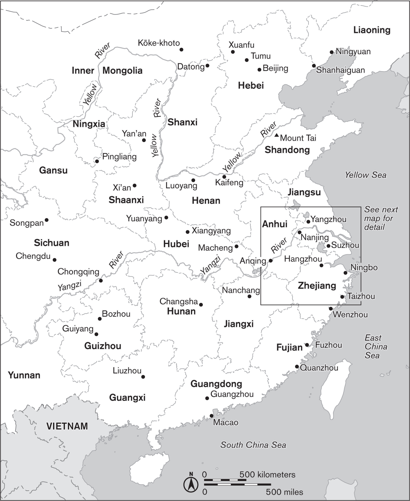
Modern China.
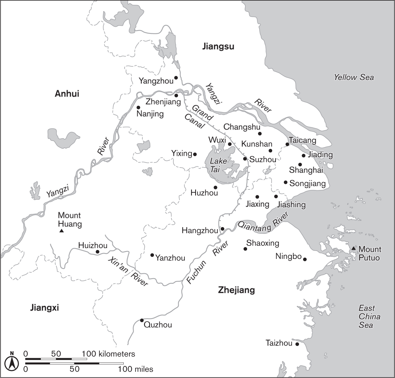
Detail of lower Yangzi region (Jiangnan).
Annotate
Close
Next Chapter
Selections from Miscellaneous Records from the Bean Garden
Previous
Next