
Skip to main content


Maps (images)
Open the image files for a quick preview or download the accompanying PDFs for higher resolution versions. You can find the full set of maps by clicking on the "total resources" link below.
Resource slideshow
Resources
15 resources. Showing results 1 through 15.
Uploaded 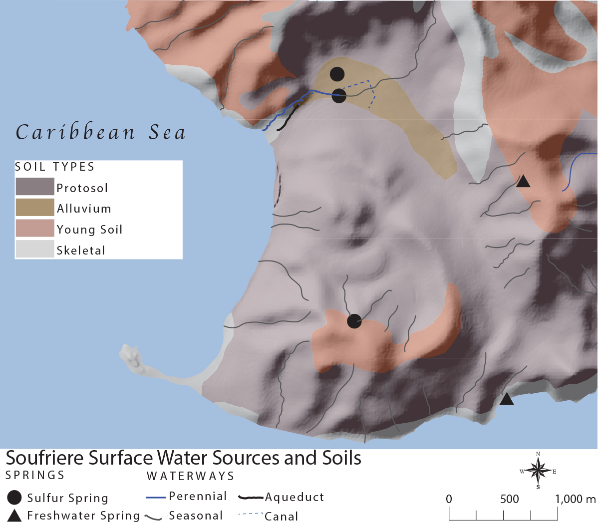
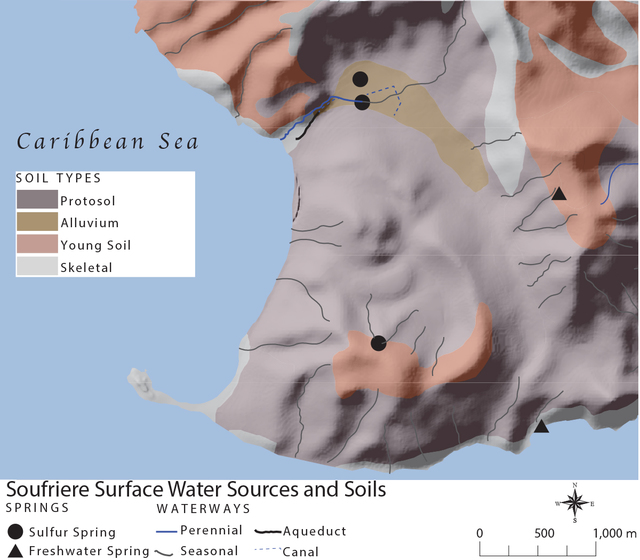
Map 1.3, Soufriere Water Sources and Soils
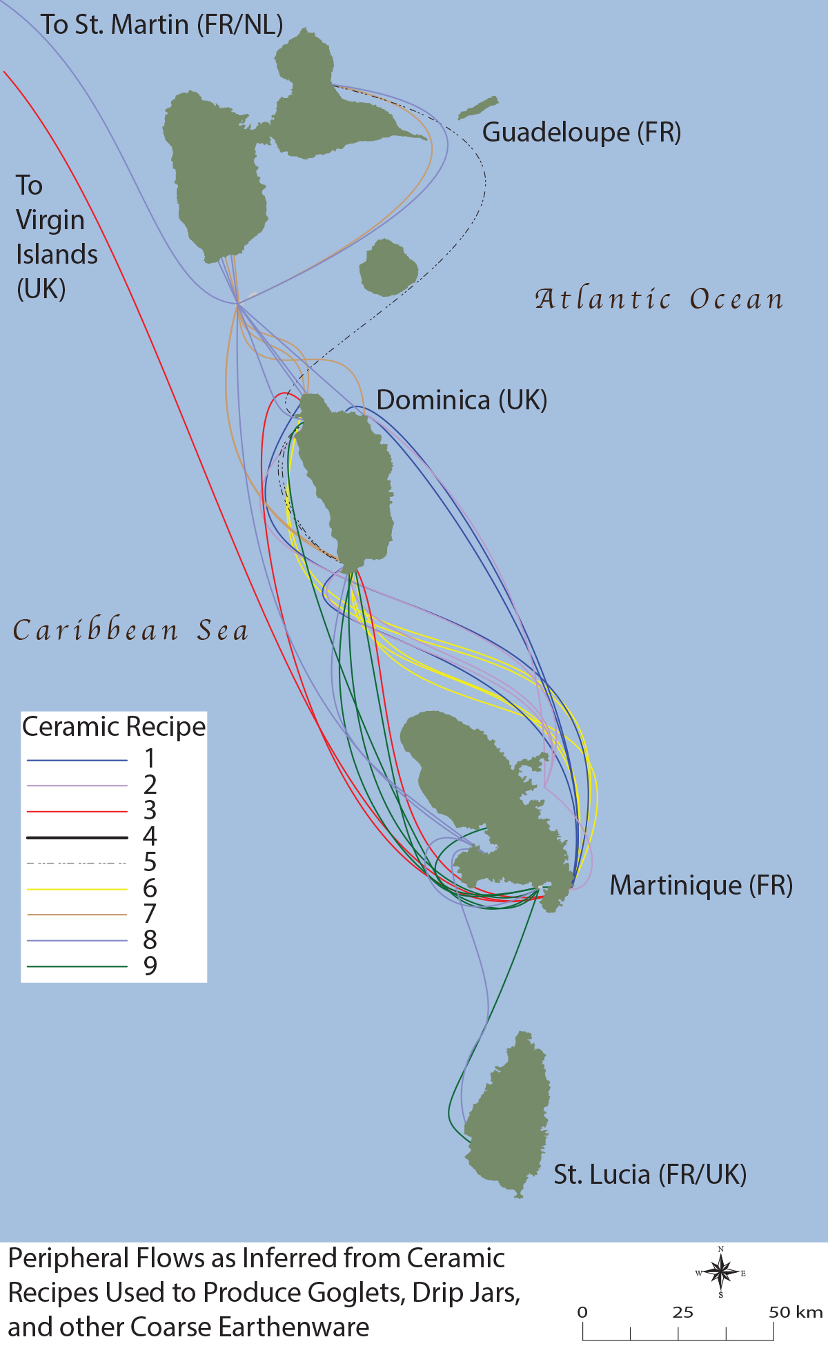
Map 4.2, Peripheral Flows
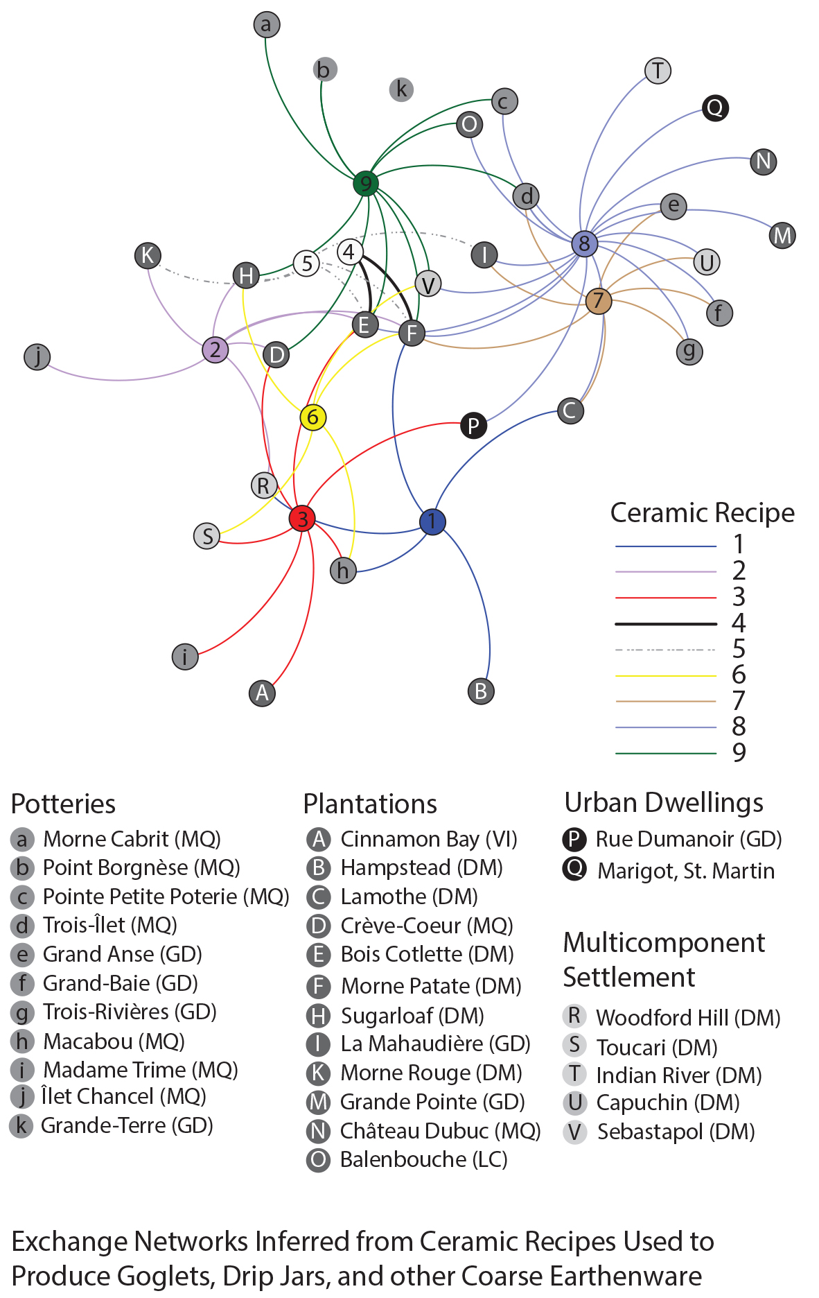
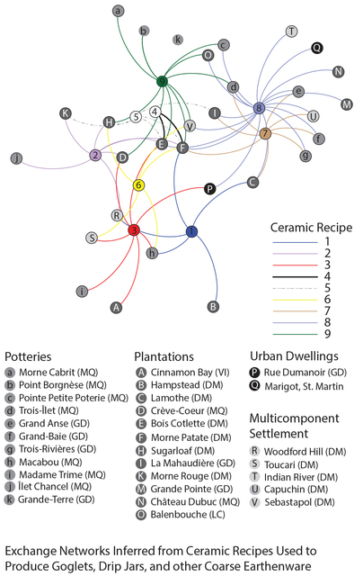
Map 4.1, Exchange Networks
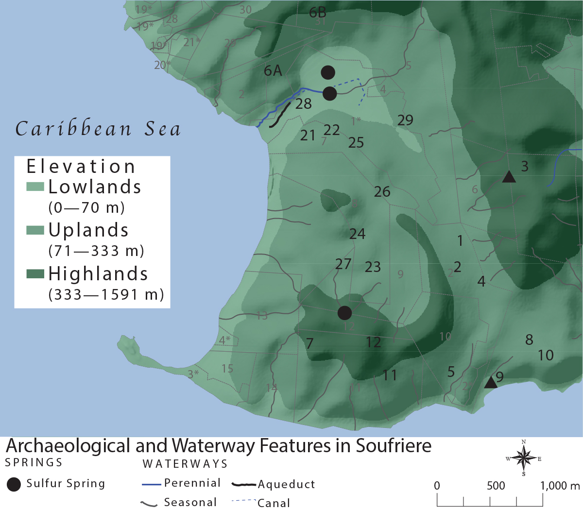
Map 3.4, Archaeological and Waterway Features in Soufriere
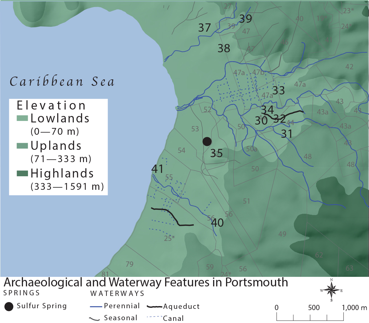
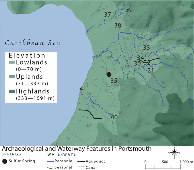
Map 3.3, Archaeological and Waterway Features in Portsmouth
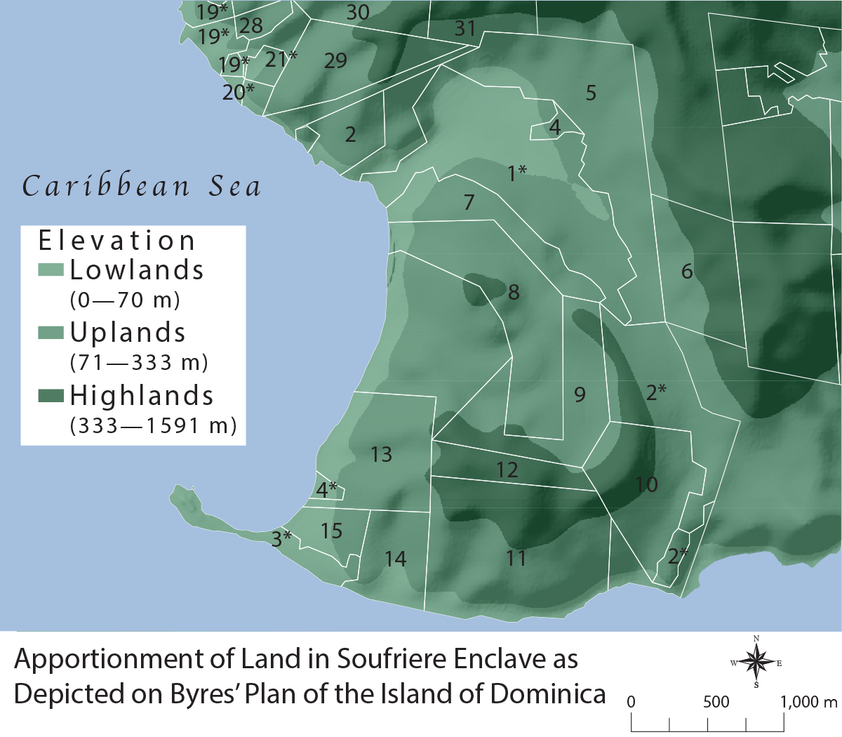
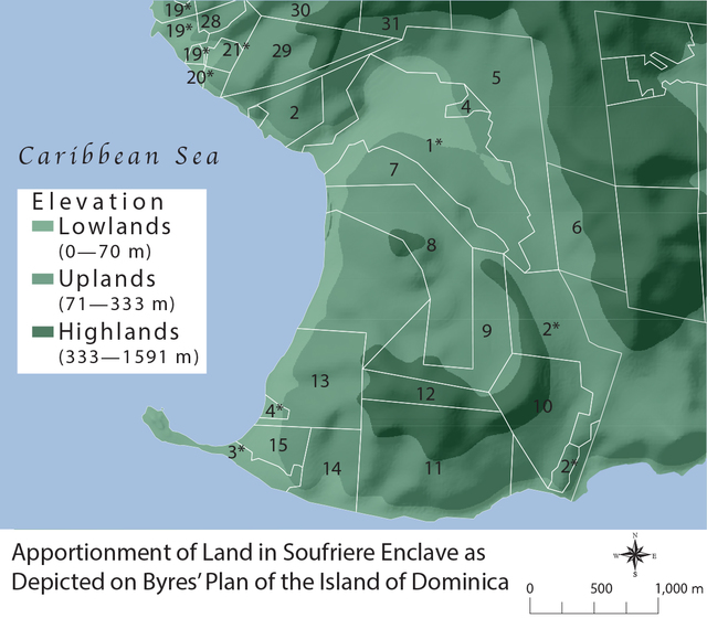
Map 3.2, Land Apportionment in Soufriere
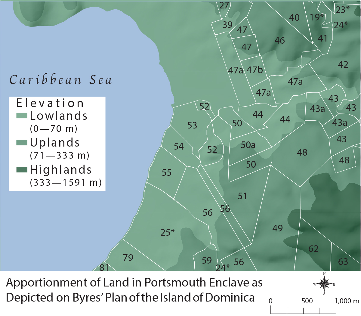
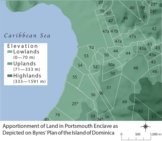
Map 3.1, Land Apportionment in Portsmouth
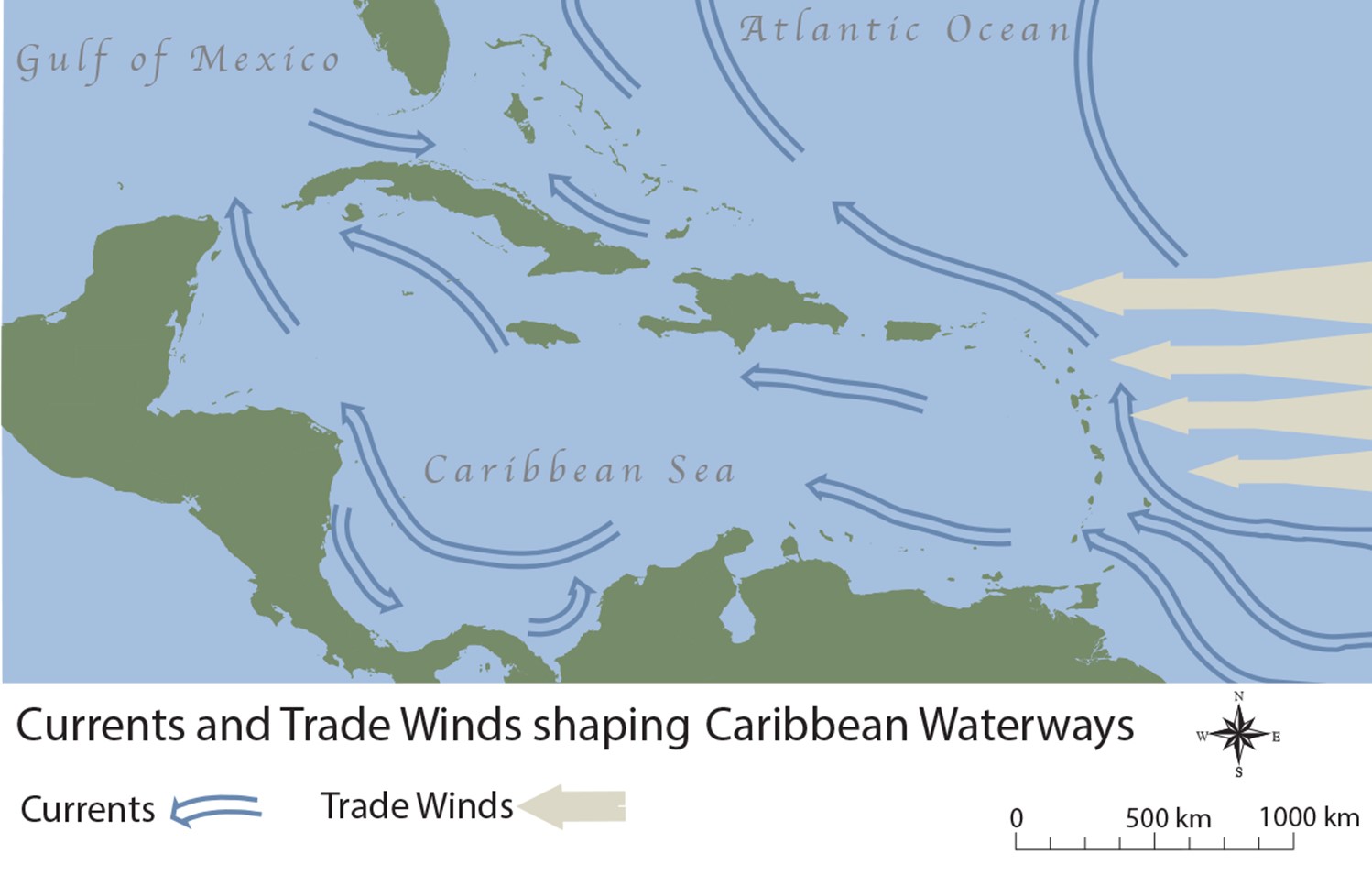
Map 2.1, Currents and Trade Winds
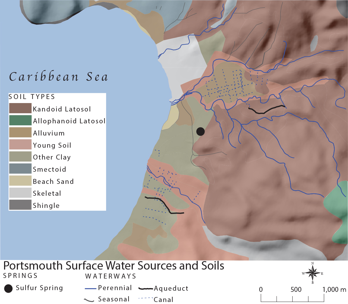
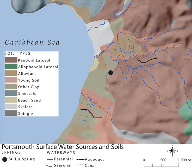
Map 1.2, Portsmouth Water Sources and Soils

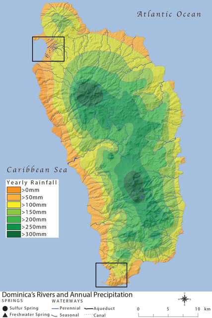
Map 1.1, Dominica's Rivers and Precipitation

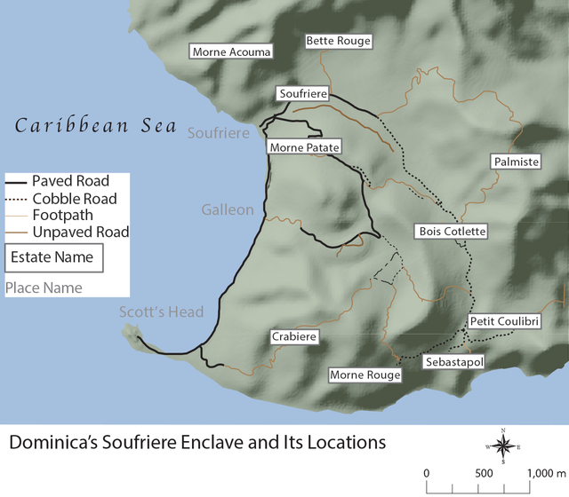
Map I.4, Soufriere Enclave
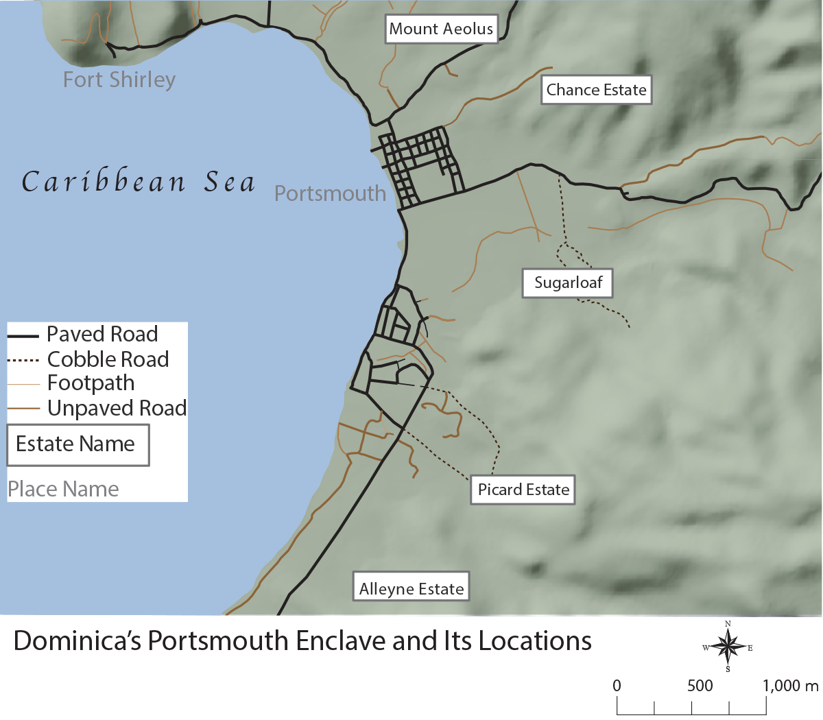
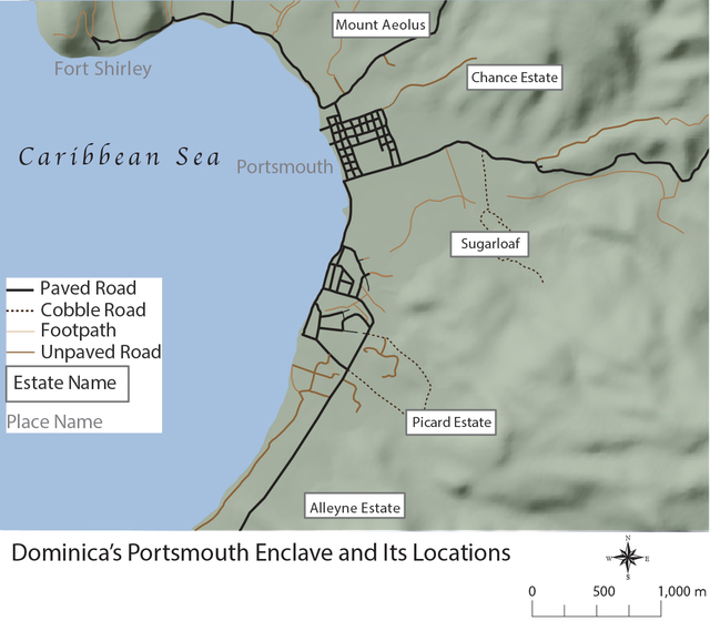
Map I.3, Portsmouth Enclave

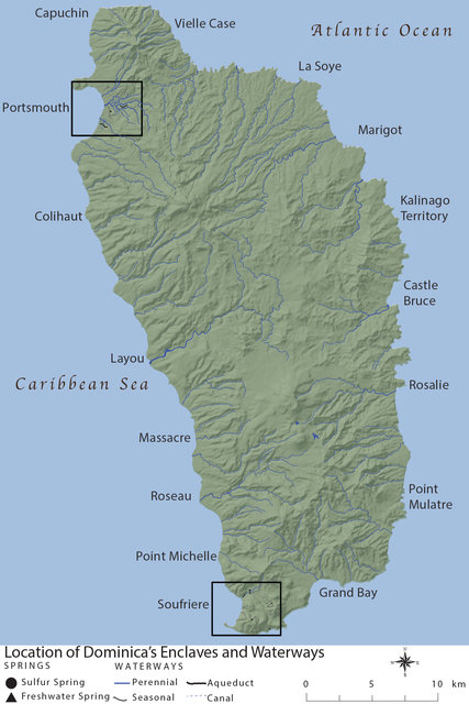
Map I.2, Dominica's Enclaves and Waterways
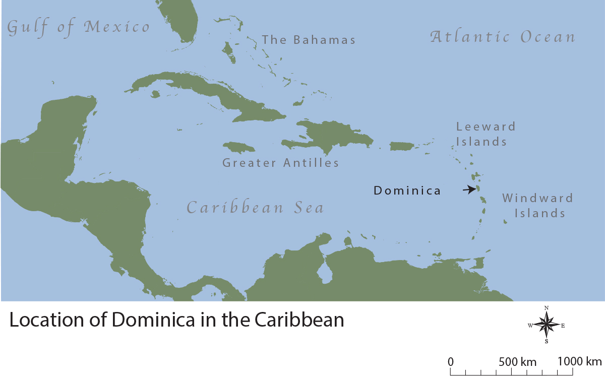
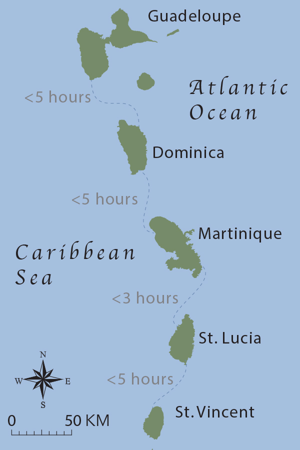
Map I.1, Dominica and the Caribbean
Annotations
No one has annotated a text with this resource collection yet.