
Empire and Identity in Guizhou: Maps

Empire and Identity in Guizhou
Maps
    • Notifications
    • Privacy
  • Project HomeEmpire and Identity in Guizhou
  • Projects
  • Learn more about Manifold

Notes

Show the following:

  • Annotations
  • Resources
Search within:

Adjust appearance:

  • font
    Font style
  • color scheme
  • Margins
table of contents
  1. Cover
  2. Title
  3. Copyright
  4. Contents
  5. Foreword
  6. Acknowledgments
  7. Maps
  8. 1 / Guizhou and the Livelihoods Approach to Zhongjia History
  9. 2 / Natural, Human, and Historical Landscapes
  10. 3 / The Consolidation of Qing Rule
  11. 4 / Livelihood Choices in the Mid-Eighteenth Century
  12. 5 / The Nanlong Uprising of 1797
  13. 6 / A Legacy of Fragile Hegemony
  14. Notes
  15. Chinese Glossary
  16. Bibliography
  17. Index

image

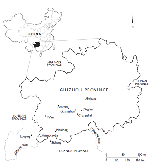
MAP 1. Guizhou’s location in China and eighteenth-century administrative divisions within Guizhou

image

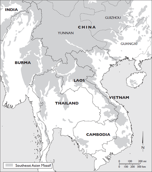
MAP 2. Guizhou’s location in the Southeast Asian Massif

image

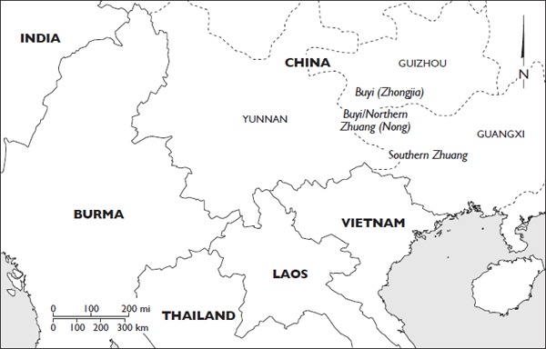
MAP 3. Distribution of the Zhongjia (Buyi) and Nong (Northern Zhuang)

Annotate

Next Chapter
Empire and Identity in Guizhou
PreviousNext
All Rights Reserved
Powered by Manifold Scholarship. Learn more at
Opens in new tab or windowmanifoldapp.org