Skip to main content
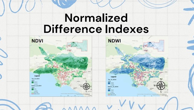
table of contents
Environmental Justice in LA County Through the Lens of Remote Sensing
Kaylan Soares, Environmental Science and Terrestrial Resource Management & Landscape Architecture
I will be analyzing greenness, wetness, and temperature data to look at environmental inequalities between income brackets in Los Angeles County. The data consists of histograms and maps that will presented in PowerPoint format.
Annotate
Symposiums