Skip to main content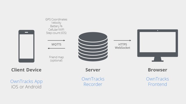
table of contents
Using Location Data From Smartphones to Time a Small Marathon
Nick Walker, Computer Science and Engineering
Mass-participation running events often rely on high frequency RFID systems for timing, which are prohibitively expensive for smaller events, leading to the use of manual, error-prone methods. We are exploring the use of OwnTracks, an open-source suite of mobile applications and server software, to collect live location data from participants' smartphones for race timing. This talk will highlight the features of OwnTracks and share our initial experiences in developing a cost-effective solution for timing a small marathon. Additionally, we'll discuss how OwnTracks enables a powerful real-time spatial data visualization that can benefit organizers and participants.
Annotate
Symposiums