Skip to main content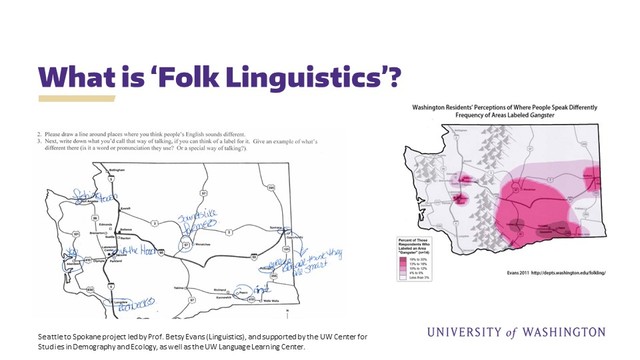
table of contents
The Folk Linguistic Online Mapping tool (FLOM) - Challenges, Opportunities and Next Steps
Russell Hugo, Language Learning Center
This presentation provides an update on the current status of (FLOM), the Folk Linguistic Online Mapping application designed as an open-source, customizable suite of tools for collecting mental maps for linguistic research. The core of this project is based around the JavaScript library of Leaflet with use of the FreeDraw module and a hack made available by Bostongraphy. Please note that we are using the legacy version of Leaflet and FreeDraw for the version currently being demo'ed on this site. For more details, please feel free to contact us.
Annotate
Symposiums