UnlockedMaps: A Web-Based Map for Visualizing the Real-Time Accessibility of Urban Rail Transit Stations
Ather Sharif, Paul G. Allen School of Computer Science and Engineering
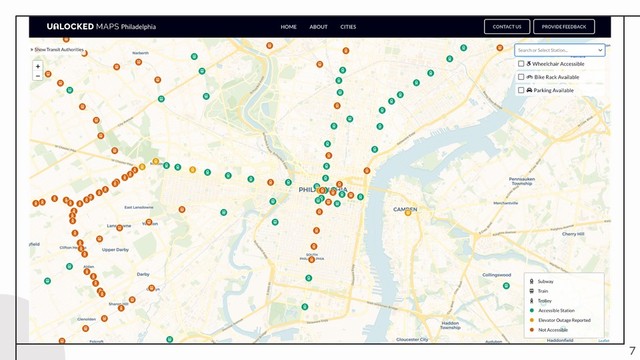
Limited visibility into real-time elevator statuses at transit stations in current web-based maps disenfranchises urban rail commuters who rely on functioning station elevators (e.g., wheelchair users). I collected the experiences of such commuters through interviews with representatives from five stakeholder groups (people with mobility disabilities, pregnant people, cyclists/stroller users/heavy-equipment carriers, disability advocates, and civic hackers). Motivated by these findings, I developed UnlockedMaps an open-data map that visualizes the real-time elevator status (accessible, experiencing at least one elevator outage, not-accessible) of urban rail stations in six North American cities and displays nearby accessible restaurants and restrooms, assisting users in making informed decisions regarding their commute.